Tornado Warning
TNC003-031-100230-
/O.NEW.KOHX.TO.W.0043.231210T0205Z-231210T0230Z/
BULLETIN - EAS ACTIVATION REQUESTED
Tornado Warning
National Weather Service Nashville TN
805 PM CST Sat Dec 9 2023
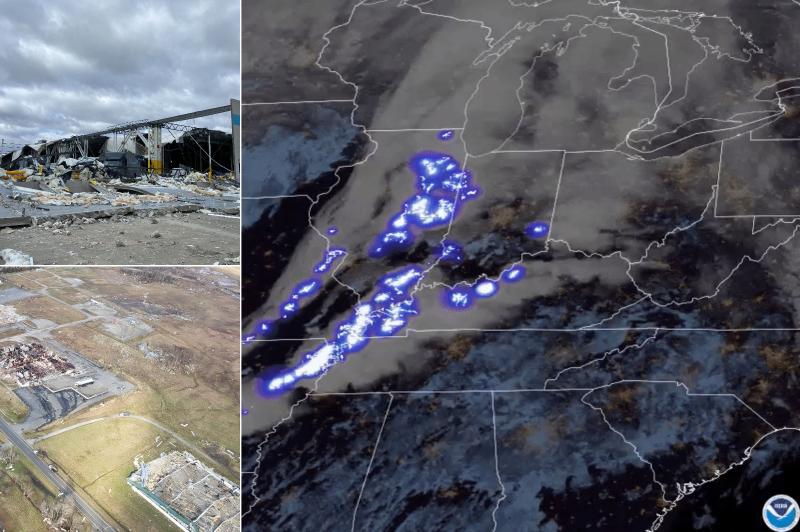
The National Weather Service in Nashville has issued a
* Tornado Warning for...
Coffee County in Middle Tennessee...
Southeastern Bedford County in Middle Tennessee...
* Until 830 PM CST.
* At 804 PM CST, a severe thunderstorm capable of producing a
tornado was located near Normandy, or 9 miles west of Manchester,
moving east at 40 mph.
HAZARD...Tornado.
SOURCE...Radar indicated rotation.
IMPACT...Flying debris will be dangerous to those caught without
shelter. Mobile homes will be damaged or destroyed.
Damage to roofs, windows, and vehicles will occur. Tree
damage is likely.
* This dangerous storm will be near...
Manchester around 810 PM CST.
Other locations impacted by this tornadic thunderstorm include
Normandy, Hillsboro, Summitville, Wartrace, and Arnold AFB.
This includes Interstate 24 between mile markers 102 and 122.
PRECAUTIONARY/PREPAREDNESS ACTIONS...
TAKE COVER NOW! Move to a basement or an interior room on the lowest
floor of a sturdy building. Avoid windows. If you are outdoors, in a
mobile home, or in a vehicle, move to the closest substantial shelter
and protect yourself from flying debris.
&&
LAT...LON 3536 8625 3537 8628 3538 8625 3539 8628
3541 8625 3541 8628 3538 8632 3551 8637
3566 8599 3561 8595 3557 8595 3554 8588
3542 8589 3537 8587 3535 8606 3536 8616
3535 8616 3534 8620 3535 8623 3534 8626
TIME...MOT...LOC 0204Z 248DEG 36KT 3546 8625
TORNADO...RADAR INDICATED
MAX HAIL SIZE...<.75 IN
$$
Shamburger

 storymaps.arcgis.com


")
