packyderms_wife
Neither here nor there.
Illinois
Severe Weather Statement
National Weather Service Quad Cities IA/IL
551 PM CST Tue Feb 27 2024
ILC073-280015-
/O.CON.KDVN.TO.W.0002.000000T0000Z-240228T0015Z/
Henry IL-
551 PM CST Tue Feb 27 2024
...A TORNADO WARNING REMAINS IN EFFECT UNTIL 615 PM CST FOR EAST
CENTRAL HENRY COUNTY...
At 551 PM CST, a severe thunderstorm capable of producing a tornado
was located near Atkinson, or 9 miles northeast of Cambridge, moving
east at 30 mph.
HAZARD...Tornado and golf ball size hail.
SOURCE...Radar indicated rotation.
IMPACT...Flying debris will be dangerous to those caught without
shelter. Mobile homes will be damaged or destroyed. Damage
to roofs, windows, and vehicles will occur. Tree damage is
likely.
This dangerous storm will be near...
Atkinson and Annawan around 555 PM CST.
This includes Interstate 80 in Illinois between mile markers 22 and
35.
PRECAUTIONARY/PREPAREDNESS ACTIONS...
TAKE COVER NOW! Move to a basement or an interior room on the lowest
floor of a sturdy building. Avoid windows. If you are outdoors, in a
mobile home, or in a vehicle, move to the closest substantial shelter
and protect yourself from flying debris.
If a tornado or other severe weather is spotted, report it to the
National Weather Service or your local nearest law enforcement agency
who will send your report. This act may save lives of others in the
path of dangerous weather.
&&
LAT...LON 4136 9010 4140 9013 4145 9011 4151 8986
4135 8986
TIME...MOT...LOC 2351Z 270DEG 25KT 4137 9004
TORNADO...RADAR INDICATED
MAX HAIL SIZE...1.75 IN
$$
Gibbs


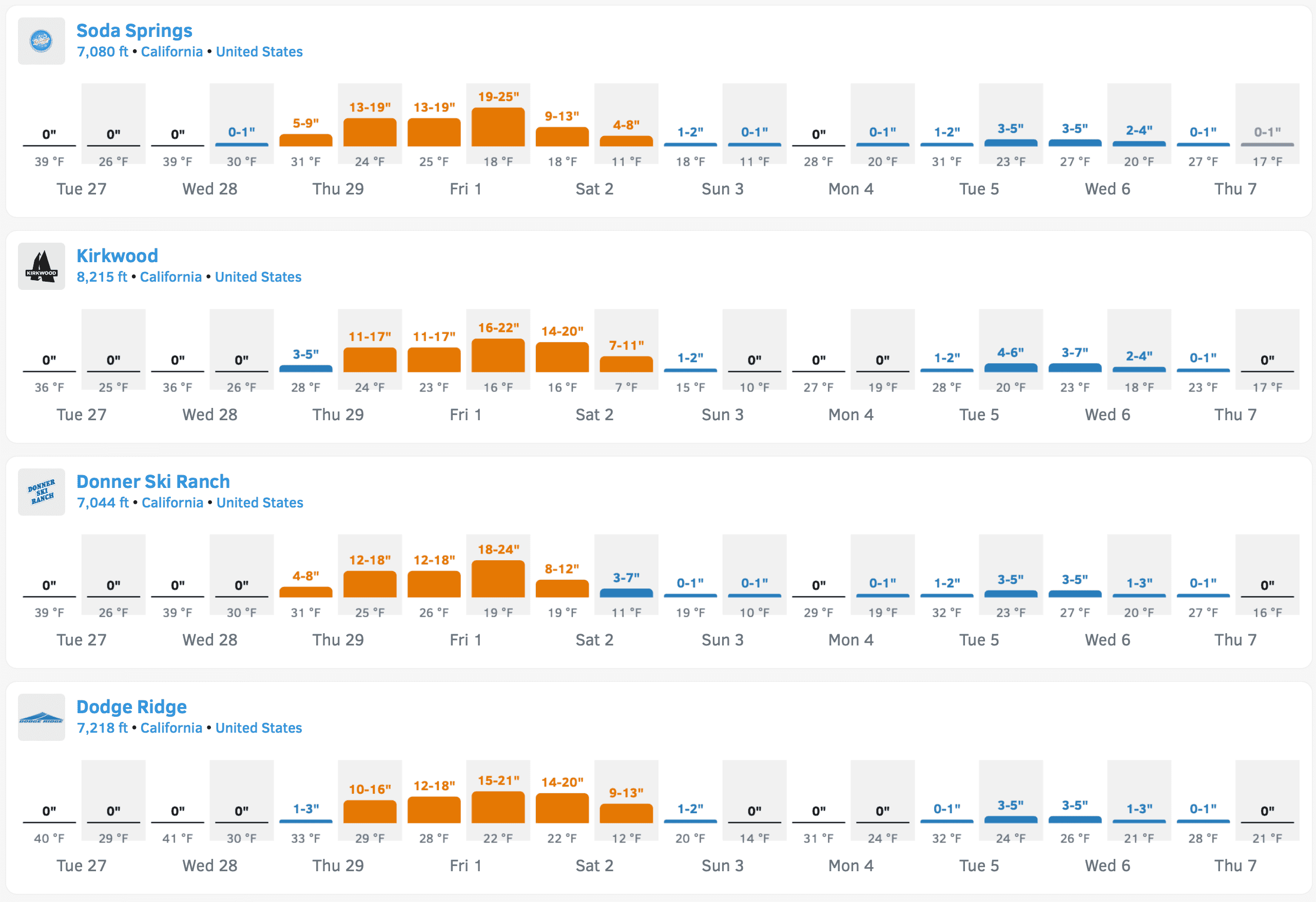
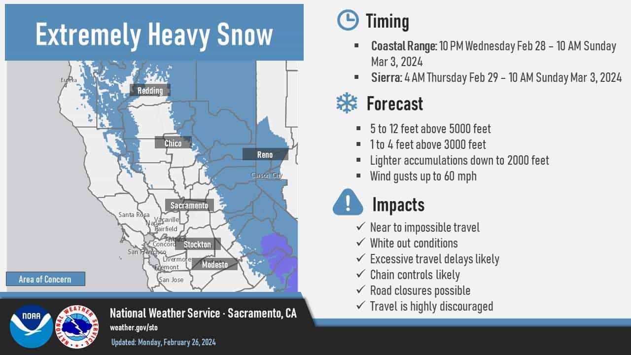
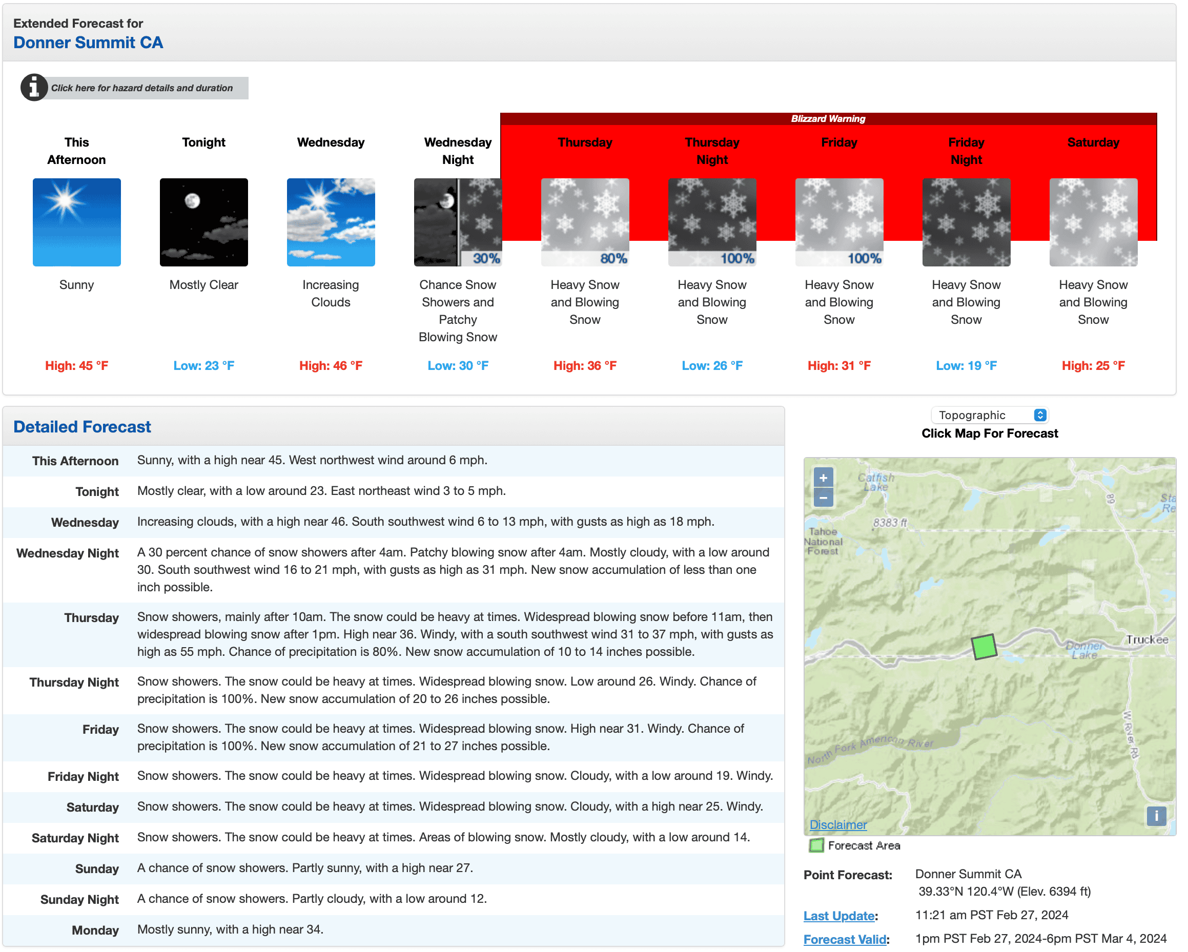
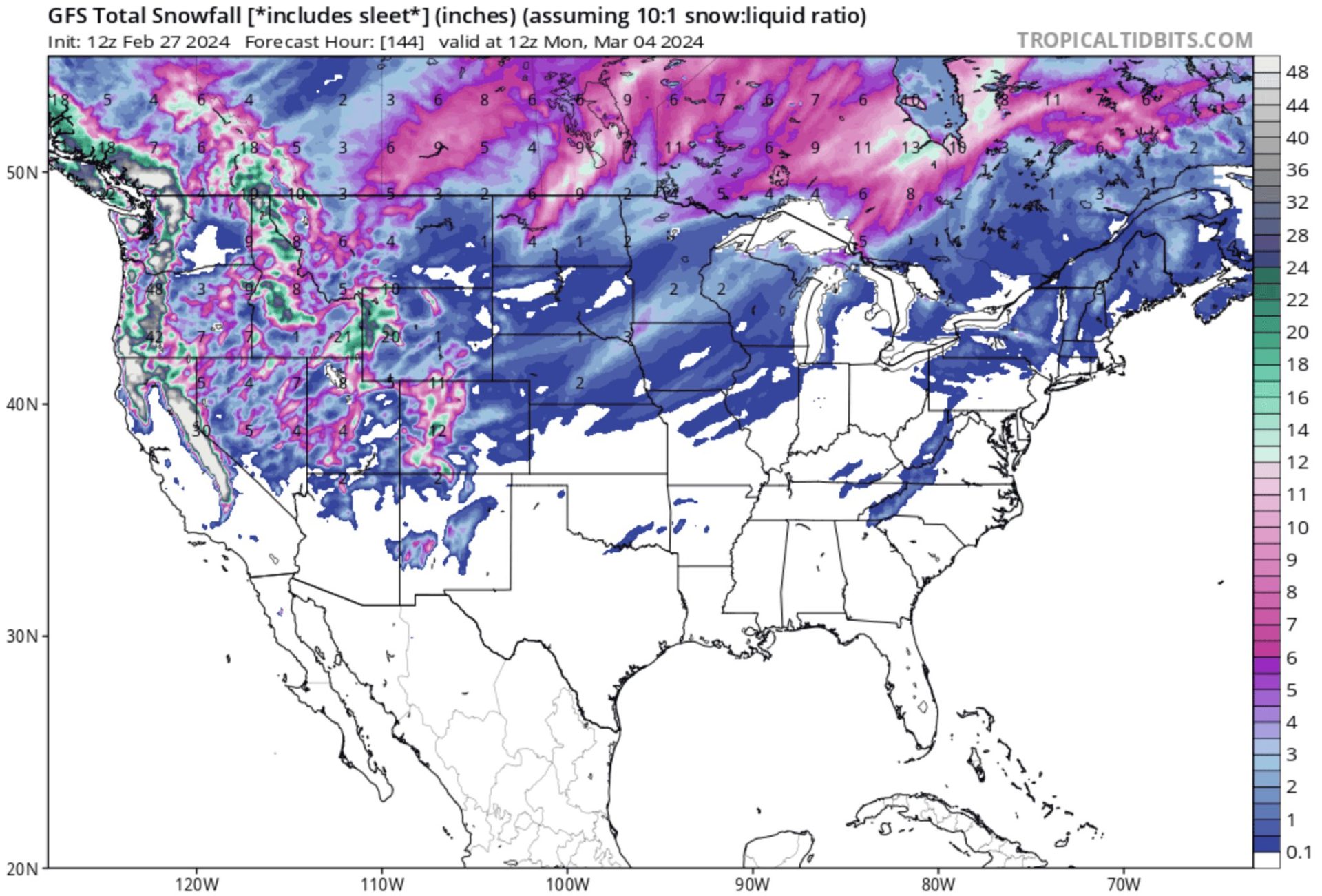
 Weather