Solar The Grand Solar Minimum (ORIGINAL)

Status
Not open for further replies.

BenIan

Veteran Member

Local rice farmers face challenging 2019 season resulting in low rice yields
December 12, 2019
By Sylvia Masters
KLFY-TV
ACADIA PARISH, La. - The 2019 rice season was difficult for rice production in Southwest Louisiana because of poor growing conditions throughout the year.

In Acadia Parish, they’re the number one rice producing parish in the State of Louisiana.
Rice yields were much lower this year because of the challenging season many local farmers faced.
Dustin Harrell, Extension Rice Specialist for the State of Louisiana and a Rice Research Agronomist for the LSU Ag Center Rice Research Station in Crowley, said, “When you look at the state as a whole, we are probably about 17% lower in our rice yields this year than we were in 2018.”

Harrell said this year, yields were around 39 barrels of rice per acre. Compare that to last year of well over 40 barrels per acre.

All because of the challenging season rice farmers endured.

Harrell added, “Last year was pretty difficult for us as far as rainfall events. We actually had three different rainfall events throughout the growing season that caused trouble for our growers.”
Had Hurricane Barry dumped more rain as forecasted, Harrell said it would’ve been a complete disaster for rice farmers.

Still, many yields were lost.

“What happened was we didn’t get as much rain, but the rice was flowering and the flower was open, and that’s when it sheds pollen and it pollinates that grain, and if you get rain and wind during that time, that can disrupt that pollination process. It’ll actually blank the grain and you can lose yield that way,” explained Harrell.

Acadiana farmers told Harrell their rice yields were about 30% lower than previous years.
“Another thing that hurt our yield potential last year was smuts, and it’s a type of disease that’ll hit the rice as it’s maturing and it’s a disease that we really haven’t worried about in the past, but we had epidemic levels of it this year,” said Harrell.
This past year, Louisiana saw 415,000 acres of rice with Acadia Parish producing 80,000.
 

northern watch

TB Fanatic
Minor earthquake strikes near eastern Ontario, several reports of shaking
Digital Writers
theweathernetwork.com
Tuesday, December 17th 2019, 11:59 am - There have been several reports of shaking.

Earthquake__1_.jpg


A minor earthquake with a magnitude of 2.9 was recorded near eastern Ontario on Tuesday morning. Several people in and near Cornwall reported that they felt the shaking around 9:19 a.m. when the earthquake struck southwest of Cornwall near the St. Lawrence River at a depth of 18 kilometres.

Reports indicate that several people also felt the shaking near the epicentre of the earthquake, which was near Massena in New York. The Ministry of Natural Resources state that there are currently no reports of damage or injuries, which would not be expected with an earthquake of this magnitude.
There are no major fault lines in this area, however, this earthquake struck in the St. Lawrence region, which is an area of Ontario that has a higher chance of experiencing an earthquake compared to other regions of the province.

Source: Natural Resources Canada

The Weather Network - Minor earthquake strikes near eastern Ontario, several reports of shaking
 

TxGal

Day by day
Adapt 2030 has two new podcasts out:

View: https://www.youtube.com/watch?v=_FWKxZHJQtw


How will the Global Economy and Grand Solar Minimum Intersect (Bob Kudla 1/2)

Run time is 35:28

Bob Kudla of http://www.tradelikeagenius.com and David DuByne from ADAPT 2030 discuss the current state of global agriculture, economy and how yields across every country are declining and what to expect as we move into 2023 with a brief interlude to the biggest crash since the Roman Empire in 2021. (AUDIO PODCAST) MIAC #260 http://adapt2030.libsyn.com/miac-260-...
•Protecting yourself from financial turmoil unfolding across the planet
•Food stocks and inflationary trends
•The Last Bastion of Functioning Fiat
•Federal Reserve Pumping $500 billion to keep the Overnight Repo market alive
•Export restrictions possible if China buys too much agricultural product and drives prices up
•Forecast 2021 US and Global both crash
•Countries the need to import food and fuel both will be the countries that fail first
•The Decentralized Future people are tired of overreach
•We haven’t prepared people how to be prepared
•Nebraska farmer grows oranges in winter in an earth walled greenhouse
•Finance is beginning to roll in for indoor agriculture in abandoned buildings
•Bob says look at DBA & MOS

---------------------------------------------------------------


View: https://www.youtube.com/watch?v=dFpPfjDVJ8k


History Just Doubled with a Possible Global Crash 2021 (924)

Run time is 10:23

New 44,000 year old cave art found in Indonesia doubling our human history and economic contraction sweeping the globe in China, India, Australia and Japan with the US Federal Reserve about to inject half a trillion $USD into the overnight lending market to prevent a global market crash.
 

TxGal

Day by day
The Oppenheimer Ranch Project has a new podcast that is a bit different:

View: https://www.youtube.com/watch?v=tn1PKjluVcQ


Dr. Chan Thomas - The Adam and Eve story - The History Of Cataclysms - Uncovering The Truth

Run time is 15:27

A declassified CIA document called The Adam and Eve Story has generated much controversy over predictions of an upcoming pole shift (aka crustal displacement) and catastrophic events that may sweep the planet in the not distant future. The 57-page document is based on a book authored by Chan Thomas in 1963. In it, Thomas proposed a pole shift scenario that differed in significant ways with what Charles Hapgood had earlier proposed in his pioneering 1958 book, The Earth’s Shifting Crust. http://bit.ly/2S6O0zp
Theory of Crustal Displacement http://bit.ly/34tr53P
A Look at The Adam an d Eve Story and a Biography of its Elusive Author, Chan Thomas http://bit.ly/2szgsiT
Postlude to the Adam and Eve story - Chan Thomas - Declassified? - The Facts & Truths - PART 1 of 2 http://bit.ly/2PVA2xN Why did the CIA classify "The Adam and Eve Story"? http://bit.ly/2Px037t
The Adam and Eve Story Declassified C.I.A. http://bit.ly/2PuwVxD
Jean-André Deluc http://bit.ly/2M5Swuh
Deluc, Jean André (DNB00) http://bit.ly/35yoKpK
Georges Cuvier http://bit.ly/2r7dMZm
The Lost World - The mastodon’s molars http://bit.ly/2r1Z4mf
Proving Extinction: Cuvier and the Elephantimorpha http://bit.ly/2EsgwDN
Scientist of the Day - Georges Cuvier http://bit.ly/34yy1g9
McDonnell Douglas Project http://bit.ly/35zpH0S
 

TxGal

Day by day
Another Adapt 2030 podcast is up. It is Part 3/5 with Celeste Solum.

Runs 30+ minutes.

As Martinhouse said, here's the new Adapt 2030 podcast:

View: https://www.youtube.com/watch?v=pYeyPrDA3jI


Is Artificial Intelligence Making Us Terraform the Planet for It ? (Celeste Solum 3/5)

Run time is 30:27

Celeste Solum author of Electromagnetic Radiation Protection Solutions and David DuByne from ADAPT 2030 discuss how society may behave in food shortages and how our planet is being altered from pollution, gene editing and A.I as we descend deeper into the Grand Solar Minimum so you can protect your families during these changing times.

•Deforesting cities to install 5G
•2023 mandate to install 5G across the EU
•Genetically modifying all life on Earth
•Earths ongoing magnetic pole reversal
•Micro Nova from the Sun
•Hyper-Preparation for continuity of government
•Growing ancient grains
•Why are farmers switching from Hard Red Winter wheat to Sorghum
•Eradicating noxious weeds & invasive species in the USA
•Cellulose filler 3% in meats and up to 18% in ice creams, cookies and other foods
•Synthetic Biology
 

Martinhouse

Deceased
I thought the information about cellulose filler in foods was interesting. Serious and disturbing, but still, interesting. I wonder if it's allowed in food that it's possible to put it in, but in various percentages? It could even be in things like catsup and mustard, if only a little bit that isn't over the amount required by law and rules for labeling. Might it be mixed in things like cornmeal and flour? Or just added extra to recipes requiring cornmeal or flour?

Kinda creepy to think that it could be in a whole lot of what we can buy in a grocery store.
 

kittyluvr

Veteran Member
I thought the information about cellulose filler in foods was interesting. Serious and disturbing, but still, interesting. I wonder if it's allowed in food that it's possible to put it in, but in various percentages? It could even be in things like catsup and mustard, if only a little bit that isn't over the amount required by law and rules for labeling. Might it be mixed in things like cornmeal and flour? Or just added extra to recipes requiring cornmeal or flour?

Kinda creepy to think that it could be in a whole lot of what we can buy in a grocery store.
Don't they put powdered cellulose in grated cheeses to keep them from clumping?
 

Martinhouse

Deceased
I just checked a very elderly shaker of grated parmesan cheese in my fridge and the list of ingredients included cellulose powder "to prevent caking". Needless to say, since the container had all but grown roots into the shelf, the contents of it were one nice little cake in the bottom, cellulose powder notwithstanding.

Tomorrow is trash pickup day. A good time to make some extra space on my fridge shelves, so thanks for mentioning this!
 

Martinhouse

Deceased
There is going to b another IAF podcast out this evening. Site says 6 PM but he is in California, so I don't know it that is his time or CST.

I was pretty sure he'd have another one out real soon, after the things he posted on his Twitter page today, but I figured it might be tomorrow.
 

TxGal

Day by day
There is going to b another IAF podcast out this evening. Site says 6 PM but he is in California, so I don't know it that is his time or CST.

I was pretty sure he'd have another one out real soon, after the things he posted on his Twitter page today, but I figured it might be tomorrow.

Yep, you were right!!

I remember way back in the 70s, I think it was, there was a new brand of bread out, and I can't recall the name at the moment. It was very, very popular, until it came out that there was cellulose in it...I can recall people talking about chopped up trees in the bread. I think it was basically pulled after that, because sales just went flat.
 

TxGal

Day by day
As Martinhouse mentioned, the Ice Age Farmer has a new podcast out, and it looks to be an important one:

View: https://www.youtube.com/watch?v=TvnkxRISycA


GLOBAL FOOD RATIONING: You Have Been Warned

Run time is 19:26

Calls for GLOBAL FOOD RATIONING have begun, and should not be dismissed. As crop losses continue and the food shortages grow, these agendas are being announced -- and in many cases, are ALREADY implemented. Join Christian to dissect the propaganda, understand the underlying agenda, and learn WHY it is all rolling out now.
 

TxGal

Day by day


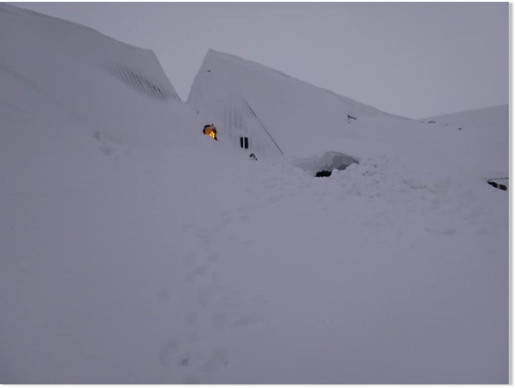
Up to 30 FEET deep snow banks in Iceland - 'We've never before had snow on this scale'


Iceland Monitor
Wed, 18 Dec 2019 15:10 UTC


Work was done yesterday to shovel the roof of the houses, as well as a shovel from a window on the 2nd floor of the building so that it could be crawled in.
"We've never before had snow on this scale," states Valgeir Þorvaldsson, director of the Icelandic Emigration Center in Hofsós, North Iceland, located in two-story houses that almost disappeared under a thick blanket of snow during the big storm last week.

"When building these houses, it never occurred to us we'd have to shovel [snow] off these roofs. There are, I believe, 9 meters (30 ft) up to the gable of the biggest house, and the roofs are very steep, too," he continues.

When contacted by mbl.is on Monday, he had just finished assisting 30 horses in accessing hay in the deep snow.

"Maybe this is why people emigrated to America," Valgeir ponders.

View: https://youtu.be/1LV7QL4QeH8


View: https://youtu.be/kf2dBqo6Vto


There is a lot of snow on Hofsós.

People worked hard shoveling snow off the roofs of the houses on Monday, in addition to clearing second story windows of snow, so they could crawl through them and into the office.

There is an immense amount of snow beyond one of the houses that make up the Emigration Center, Valgeir states. If those huge snow banks start moving, he doesn't believe the house will remain standing. Therefore, it is essential to make sure no one is inside, he adds.

Valgeir states that a great deal of work remains for people to get things running again after the storm and the accompanying power outage - not least for farmers.
 

TxGal

Day by day
(a few twitter posts/graphic inserts didn't make it over, please go to the link to see)


snowstorm-finland-2-e1576753096382.jpg
Extreme Weather GSM

Severe Winter Storm “Aapo” cuts Power to 55,000 homes in Finland December 19, 2019 Cap Allon

Heavy, wet snow has knocked-out the power to tens of thousands of homes in inland parts of southern and central Finland Wednesday afternoon, as an intense early-season snowstorm buries the Scandinavian nation.

The Finnish Energy industry group (ET) said that up to 55,000 households had lost power across south-central and eastern Finland by Wednesday evening, as well as a few in Kittilä, Finnish Lapland, and in Sipoo on the south coast.

That number is expected to rise even higher through Thursday and Friday, as a second wave of heavy snow and freezing rain moves in from the southwest.

Strengthening winds are also predicted to cause problems.

Eckerö Line cancelled at least two ship departures, while across south-central and eastern Finland, the Finnish Meteorological Institute (FMI) warns of very poor road conditions due to the snowstorm.

And once finished with Finland, the storm is Russia-bound, adding to the staggering snow totals suffered across that transcontinental nation already this season (and it still isn’t even winter!).


Looking forward, intensifying swings-in-extremes are in the weather forecast globally, for all of us, as historically low solar activity continues to weaken the jet stream, reverting its usual tight zonal flow to more of a wavy meridional one:
Polar-Vortex-2.jpg


And depending on what side of the jet stream you’re on, you’re either in for debilitating polar cold or anomalous tropical heat.

This week in the NH, for example, the majority of North America is suffering well-below average temperatures, while much of Europe is experiencing unusually mild conditions:


  • Mild-Europe-Dec-1.jpg
    Mild Europe, Dec 18
  • cold-us-dec.jpg
    Cold North America, Dec 18
    Mild-Europe-Dec-1.jpg

And in the SH, South America is suffering anomalous cold, while Australia currently bakes:


  • Aussie-bakes-Dec.jpg
    Hot Australia, Dec. 19
  • cold-S-America-Dec.jpg
The full picture is never revealed by the MSM, their agenda-driven reporting allows only for one side of the story — heat and drought.

But the truth, regardless of what side of the jet stream you’re on, is that both of these setups can negatively impact crop production. And we’re already witnessing dramatic falls in yield and quality across the breadbaskets of the world — the price of wheat, for example, is now at a four-and-a-half year high, and rising fast.

An intensification of this meridional jet stream flow is in all of our futures, and the phenomenon isn’t caused by increasing atmospheric CO2 levels — if anything, more carbon dioxide is having a beneficial affect as the trace gas has been proven to increase plant growth.

No, it isn’t you or me that’s causing this climate shift, it’s the sun — as it always has been:

Overall, global average temperatures are falling in line with this historically low solar activity, and glacial advance has once again kicked-in.

Heatwaves will always still occur –the evidence suggests they could even become more extreme– although the waves will be short lived and/or localized to regions residing ‘under’ the JS.

Don’t fall for NOAA’s or the BOM’s politicized, warm-mongering, UHI-ignoring temperature datasets — our future is one of ever-descending cold, crop loss and struggle.

Prepare accordingly
— grow your own.


Solar-Cycle-25-NASA-full.png
 

Martinhouse

Deceased
I don't remember where I posted about my new chickens not laying yet. But, Summerthyme, you suggested I might need a light out there to stimulate laying.

I was wondering if you, or anyone else, can tell me what Watt bulb I should use if I decide to just use an extension cord and a reflective shop light with an incandescent bulb?

I do remember (I think) that there should be at least 14 hours of light for good laying, but I don't know how bright it should be. Since the pen/house is fairly dark all the time, I'd probably leave the light on from roughly 7 AM until maybe 9 PM.

Edit: If wattage depends partly on how large an area is to be lit, the pen/house is approx. 8' x 24' and is open chicken wire on the 8' east end, chicken wire covered with clear vinyl on the 8' west end, Tarp with the silver side inward covers the entire 24' north side. The 24' south side is open chicken wire and the westernmost 2/3 of it is protected and heavily shaded by the tarped roof of the open structure to which it is attached.
 
Last edited:

TxGal

Day by day
We actually put up a solar light on our chicken house some years back. I don't recall the wattage, but it wasn't too high because this was in the fully enclosed house (with two chicken doors). We haven't kept up with it and would need a new one, I'm sure. I don't know how strong it would have to be, it will be interesting to see the replies.
 

summerthyme

Administrator
_______________
It doesn't need to be very bright at all. I used 13 watt florescent bulbs in an overhead fixture for years. So, anything like a 25 or 40 watt incandescent, or a small compact florescent, should be fine.

Summerthyme
 

Martinhouse

Deceased
Thanks to both of you guys for your answers. Could you tell me how large your chicken houses are? I figure I'll need a brighter bulb because I'm trying to put a lot of light into an 8' x 24' mostly enclosed pen. It's lots bigger than my previous chicken house.
 

TxGal

Day by day
The Oppenheimer Ranch Project has a new podcast out:

View: https://www.youtube.com/watch?v=dFpcXhGfPAc


Pineapple Express To Bring Flooding, Snow to West Coast - Colorado -44 - Scientists are Baffled!

Run time is 20:52

Part of Upper Peninsula approaching 10 feet of snow already http://bit.ly/2Q1jx3b
Snow for the Northwest, West Coast, & Southwest http://bit.ly/2kB5Jkd
-44º temperature reported overnight in Colorado http://bit.ly/36MF0n8
Snowfall Analysis http://bit.ly/37ZQHZh
Pineapple Express storm to bring flooding, snow to West Coast http://bit.ly/2SbFSxy
Cold, blustery Canadian air to leave Northeast shivering http://bit.ly/2rf2Adg
Atmospheric river, tropical downpours https://cbsn.ws/35GKgbZ
Arctic cold front brings subzero wind chill temperatures http://bit.ly/2tt5pIf
'Category 3' Atmospheric River heading our way. What's that mean?!? http://bit.ly/35GfbFk
GFS Total Snow http://bit.ly/2EA9DjF
Stormy Weather in the West; Developing System along the Gulf Coast http://bit.ly/2p2GER3
Pacific Northwest Volcano Forecast To Erupt Within 4 Years http://bit.ly/2ScMHz0
Santa Isabel https://s.si.edu/2s3LHTa
Worldwide Volcano News and Updates http://bit.ly/2v9JJhO
Our sun just set a record for spotlessness http://bit.ly/34AncKp
Climate politics is a dead end. https://wapo.st/2s3LZte
More Greenhouse Gas From Organic? http://bit.ly/36TpTby
Six companies are about to merge into the biggest farm-business oligopoly in history https://yhoo.it/34BJ3RF
and more


TxGal

Day by day
As we all prep for the GSM changes, this is an article that we need to keep in mind:


“Pig Ebola” Is Now Running Wild In Indonesia, And It Has Already Killed About One-Fourth Of The World’s Pigs

December 18, 2019 by Michael Snyder

The global pig population is being absolutely decimated by a disease that does not have a cure. African Swine Fever, also commonly referred to as “Pig Ebola”, is raging out of control in dozens of countries all over the globe. It has a mortality rate of close to 100 percent, and once it hits an area even the pigs that are able to survive the disease are killed off in order to prevent it from spreading elsewhere. Unfortunately, African Swine Fever just continues to pop up in more locations. As you will see below, it is now sweeping through the heavily-populated nation of Indonesia. Nearly 270 million people live in Indonesia, and they are heavily dependent on pork as a source of protein. But of course the same thing could be said about almost all of the countries where African Swine Fever is currently raging.

The mainstream media in the U.S. hasn’t been properly reporting on this crisis, and that is likely because this disease has not spread to our nation yet.

But let there be no doubt – this is truly a crisis of Biblical proportions. In fact, it has been estimated that this epidemic has already killed about one-fourth of the world’s pigs. The following comes from an Australian news source

Experts say the disease has wiped out an estimated 25 per cent of the world’s pig population.
The fever has been reported in around 50 countries, including China, Belgium, Slovakia, Cambodia, North Korea, South Korea, Vietnam and the Philippines.

And this same figure is being quoted by the New York Daily News

African swine fever has been reported in nearly 50 nations — including China, South Korea, the Philippines and Belgium — and it’s causing an incredible crisis on a global scale. Alarmingly, more than one-quarter of Earth’s pigs have been wiped out by the virulent disease.

This should be front page news all across America, but of course the big news networks really don’t want to talk about anything other than the impeachment of Donald Trump these days.

Unfortunately, everyone on the entire planet is going to feel the pain of this crisis as it continues to intensify. We are potentially facing a serious global pork shortage, and this disease continues to pop up in new areas. When it recently began spreading in Indonesia, it made headlines all over the globe. The following comes from Reuters

Nearly 30,000 pigs have died from African swine fever (ASF) in Indonesia’s North Sumatra province as of Dec. 15, causing millions of dollars of economic losses as authorities try to quarantine the areas affected, officials said on Wednesday.
The Agriculture Ministry has declared an outbreak of the highly contagious virus in the country and said it is contained only in some parts of North Sumatra, minister Syahrul Yasin Limpo told reporters.

Asian countries rely very heavily on pork to feed their populations, and the severe losses that we are witnessing are not going to be easy to replace. At this point, Indonesia has become the 11th Asian nation where African Swine Fever is spreading…

To date, 11 Asian countries have reported outbreaks since August 2018, including Indonesia, Mongolia, North Korea, South Korea, China, the Philippines, Vietnam, Laos, Cambodia, Myanmar and Timor-Leste.

The epicenter for this crisis is in China. The Chinese produce and eat more pork than anyone else in the world, and it was recently projected that their hog herd “will likely shrink by 55% by the end of the year” due to this disease…

China’s hog herd fell by half in the first eight months of 2019 due to a devastating outbreak of African swine fever and will likely shrink by 55% by the end of the year, analysts at Rabobank said on Wednesday.

As I detailed in a previous article, it has been estimated that 150 million pigs have already died in China.

To put that in perspective, there are only about 70 million pigs in the United States right now.

So you could kill every pig in the United States twice and you would still not get to the total that have already died in China because of this epidemic.

Needless to say, pork prices are absolutely soaring in China. They have more than doubled since this time last year, and in November we saw another huge jump in Chinese food inflation. The following comes from Zero Hedge

As has been the case for the past year, the culprit behind the headline CPI surge was food inflation, which accelerated further to a record +19.1% in November from +15.5% in October, primarily on higher inflation in fresh vegetable and pork prices.

So what is the bottom line?

The bottom line is that this is an extremely serious threat to the global food supply.

Beef, chicken, fish and pork are the four main global sources of protein, and right now pork is already in very short supply in some parts of the world.

And of course this comes at a time when global weather patterns are going absolutely nuts and we have seen disastrous harvest seasons all over the planet.

We are entering the time of “the perfect storm”, and most people have absolutely no idea what is ahead of us.

Even if you don’t eat pork, this is a story that you need to keep a very close eye on, because this is going to push up food prices everywhere. Demand for beef, chicken and fish will increase as pork becomes more expensive and consumers turn to other options. And in some of the poorer places around the world, some impoverished families may have to start cutting meat out of their diets entirely.

We have never seen a crisis quite like this in any of our lifetimes. Despite all of our advanced technology, we are still dependent on farmers to produce the food that we eat, and this is truly an existential crisis for the entire global pork industry.

There is no way to spin this to make it sound nicer. Many are hoping that this outbreak will subside eventually, but right now it doesn’t look like that will happen.

And once this disease reaches the United States, we will start to experience the same panic that is already sweeping through nearly 50 other nations around the globe.
 

summerthyme

Administrator
_______________
Thanks to both of you guys for your answers. Could you tell me how large your chicken houses are? I figure I'll need a brighter bulb because I'm trying to put a lot of light into an 8' x 24' mostly enclosed pen. It's lots bigger than my previous chicken house.
Mine is 6'x16'... honestly, they don't need much light. They absorb it into their pineal gland... They don't need to be able to read a newspaper. The solar light I have now is just bright enough for me to be able to (barely) see the darker eggs to gather, and enough to see the birds. But it's definitely not bright. It worked well all last winter.

Summerthyme
 

Martinhouse

Deceased
Summerthyme, thanks. I'm probably going to run an extension cord out to the chicken house and use the shoplight. I may use an LED bulb, since one of those won't raise my electric bill as much as if I would spend if I had to buy eggs at the store.

TxGal, the Oppenheimer Ranch Project podcast is the one I referred to as the pot-cast. Sorry. And I see there's another one posted since the one I referred to as a "pot-cast".
 
Last edited:

summerthyme

Administrator
_______________
Just make SURE the LED bulb puts out WARM (yellowish) light. There are color temperature charts online.... Color temperature - Wikipedia ... most bulbs have their color temperature on the label. And for sure, an LED bulb will be much kinder to your electric bill.

Summerthyme
 

Martinhouse

Deceased
I was sorting out a cabinet with stored canned goods in it and discovered three and a half cases of the standard size cans of chili beans. Their best-by date is Dec. 2015. I'm going to see if the chickens will eat them. If so, I also have old rice I can cook up for them to go with those beans and PRESTO! there's some of the protein they need and I will now have chickens with their very own prepper diet!

I must have forgotten about storing these cans because I bought them around the time my acid reflux was about to get bad and then I couldn't eat chili bean soup any more. Now that I have chickens again, I won't have to be so upset with myself about letting things like this go to waste.
 

northern watch

TB Fanatic
New USGS hazard map shows increased earthquake risks
Mario Picazo
Meteorologist, PhD
The Weather Network

Friday, December 20th 2019, 1:08 pm - USGS latest National Seismic Hazard Model shows increased earthquake risks for parts of the continental United States

It’s no surprise that some areas of the U.S. west coast are increasingly facing a higher risk of a major earthquake occurring. According to the United States Geological Survey (USGS), much of California, and some areas of western Nevada, are among the areas with a higher chance of experiencing a significant ground shaker
.

Every five years, the USGS releases an updated seismic hazard map which marks very clearly in red, those zones that are especially vulnerable to earthquake activity. Over the past five years, a new set of earthquake observations across the U.S. has helped improve model performance. For instance, data from the Ridgecrest earthquake which occurred back in July of this year showed geologists that quakes can be very complex, but at the same time the information gathered during this event was extremely valuable to update the hazard models which calculate the impact they can have in a given area.

Map_1_Seismic_Risk_Large_USGS.png

USGS Seismic Risk Updated Map

USGS scientists have been incorporating the latest updates to their National Seismic Hazard Model, in order to better predict the near future of earthquake impact. More detailed information of past and recent quakes, new ground shaking computer models, improved representation of ground shaking in areas located over unstable terrain and more detailed information on shaking depending on building or soil type, are just a few of the main updates included in the recent version.

The USGS National Seismic Hazard Model Project Team has included a broad spectrum of shaking scenarios since different shaking wavelengths affect structures differently. For instance, a shorter wavelength, which moves faster, will have a greater influence on a shorter structure, while the longer, slower-moving wavelengths, will have more of an impact on tall buildings and bridges.

The geology of the ground is also greatly improved in these contemporary models since soil type and structure is decisive when it comes to factoring in this information to asses potential hazards in a given area. Buildings, bridges, dams, railways, schools and other structures also have specific material codes. These come from the work of civil engineers and are included within the Seismic Hazard models so that the output can be of great value to help entire communities prepare for a significant earthquake.

Photo_1_USGS_San_Andreas_Fault.jpg

San Andreas Fault. Courtesy: USGS


Beyond improving computer models that alert us of potential hazards during an earthquake, we have another major problem as urban centres continue to expand. Population in large metropolitan areas just continues to grow, and rapidly. In urban areas of California, the number of people exposed to unstable grounds has also been on the rise decade after decade. The Bay area in northern California and the greater Los Angeles area are among two of the most densely populated areas facing this threat.

Overall, there are more people living in areas where seismic hazards are a reality than ever before, and this number will only continue to grow. Today, 1 in 10 U.S. people live in areas where the risk of experiencing intense ground shaking is high. The western third section of the U.S. is one of those areas where the chance of experiencing a damaging earthquake is at least 36 to 74 per cent, and across a large swath that includes almost all of California, above 74 percent. Other areas at moderate to high risk are found in areas of Missouri, Tennessee, Arkansas, Kentucky or Illinois.

Map_2_UCERF3_postcard.jpg

California Rupture Zones. Courtesy: USGS

Californians -- especially those living in the Bay area -- are perfectly aware that sooner or later, within a time frame of now to 100 years, the ground will shake intensely. In the meantime, all the extra time they can get should be used to improve as much as possible the resistance of all structures, but also the quality of those seismic hazard models which can help save many lives.

The Weather Network - New USGS hazard map shows increased earthquake risks
 
Last edited:

Martinhouse

Deceased
Northern watch, thanks for posting this. I live in north central Arkansas, fairly well outside of the yellow zone shown in the map, but there would still be consequences from a big quake if the New Madrid Fault decided to let us have it in a big way.
 

TxGal

Day by day

New study blames underwater volcanism for catastrophic global cooling, famine, civil upheavals in Medieval times

December 20, 2019 by Robert


This confirms what I’ve been saying years, that underwater volcanoes can lead, not only to cooling, but to ice ages.
___

Researchers presented underwater volcanism as the reason why the sky went dark for more than a year beginning 536 A.D. At that time, some parts of Europe and Asia saw the Sun for only about four hours a day, and even when the Sun was visible, accounts say it gave no more light than the Moon for 18 months. The dimming led to catastrophic global cooling, famine, and civil upheavals in Medieval times.

This period of darkness and cooling marked the beginning of a longer period from 536 to 555 A.D. as trees struggled to grow, indicating that the dimming was extensive.

536 A.D. was also one of the worst periods to be alive, according to Harvard University medieval historian Michael McCormick, who is not part of the study.

“People thought it was the end of the world,” said Dallas Abbott who studies paleoclimate and extraterrestrial impacts at Columbia University’s Lamont-Doherty Earth Observatory.

Abbott and her colleague John Barron from the USGS said their study of a Greenland ice core (GISP2) pointed to underwater eruptions near the equator that carried calcium-laden sediments and microscopic sea creatures into the atmosphere, which helped dim the sunlight.

“We found by far the most low-latitude microfossils that anybody’s ever found in an ice core,” said Abbott.

Undersea volcanism as the cause of 'year of darkness' and upheaval period from 536 - 555 A.D.
Thanks to Guy Wilson for this link

Related:

“New ice core evidence for a volcanic cause of the A.D. 536 dust veil” – Larsen et al. – Nature – DOI: 10.1029/2007GL032450

Abstract

New and well‐dated evidence of sulphate deposits in Greenland and Antarctic ice cores indicate a substantial and extensive atmospheric acidic dust veil at A.D. 533–534 ± 2 years. This was likely produced by a large explosive, near equatorial volcanic eruption, causing widespread dimming and contributing to the abrupt cooling across much of the Northern Hemisphere known from historical records and tree‐ring data to have occurred in A.D. 536. Tree‐ring data suggest that this was the most severe and protracted short‐term cold episode across the Northern Hemisphere in the last two millennia, even surpassing the severity of the cold period following the Tambora eruption in 1815.
 

TxGal

Day by day
Adapt 2030 has a new podcast out:

View: https://www.youtube.com/watch?v=KK9C5wCFygQ


Global Atmospheric Shift Algeria Emerges as a New Bread Basket (925)

Run time is 13:30

Unusual vortex winds across our planet continue to increase as the Suns out decreases. Highest ever recorded tornado in Bolivia, water spouts in Indonesia, tornado out breaks in December USA, 2x Medicanes in a month North Africa dumping record snowfall in November. A month of rain in hours 4x in the last 30 days and record crop yields in Norther Africa from all the additional rainfall for the 3rd year in a row.
 

TxGal

Day by day
Oppenheimer Ranch Project has a new podcast out:

View: https://www.youtube.com/watch?v=rQCMhT8fSLo


Mavstar Observatory Update with Gene Beards - World Magnetic Model Error Corrected

Run time is 34:07

Our primary focus is the tracking of the geomagnetic north and south poles, why? because for the last 100 years the magnetic poles have been migrating on earth, and more recently covering greater distance in shorter time periods. http://bit.ly/2EG9rzm Maverickstar Reloaded on YouTube http://bit.ly/39233jN Newest pole Position Map WMM http://bit.ly/34FKHly
 

TxGal

Day by day

In ancient Scottish tree rings, a cautionary tale on climate, politics and survival

Sciencemag.com
Fri, 20 Dec 2019 21:48 UTC

In_ancient_scottish_tree_rings.jpg


A 1600s famine with echoes in the age of Brexit

Using old tree rings and archival documents, historians and climate scientists have detailed an extreme cold period in Scotland in the 1690s that caused immense suffering. It decimated agriculture, killed as much as 15 percent of the population and sparked a fatal attempt to establish a Scottish colony in southern Panama. The researchers say the episode-shown in their study to have been during the coldest decade of the past 750 years-was probably caused by faraway volcanic eruptions. But it was not just bad weather that brought disaster. Among other things, Scotland was politically isolated from England, its bigger, more prosperous neighbor that might have otherwise helped. Propelled in part by the catastrophe, the two nations merged in 1707 to become part of what is now the United Kingdom. Such a famine-related tragedy was never repeated, despite later climate swings.

With Brexit now threatening to isolate the UK from the European Union, the researchers think politicians should take this as a cautionary tale. "By joining England, Scotland became more resilient," said lead author Rosanne D'Arrigo, a tree-ring scientist at Columbia University's Lamont-Doherty Earth Observatory. "The bigger message for today is arguably that as the climate changes, nations will be stronger if they stick together and not try to go it alone." The study appears in the early online edition of the Journal of Volcanology and Geothermal Research.

The "Scottish Ills" have long been noted in history books. In some years, snow from the winter persisted on the ground well into summer, and frosts struck every summer night for weeks. The planting season was cut short, and crops were struck down before they could be harvested. Livestock had nothing to eat. The study quotes Mary Caithness, Countess of Breadalbane, describing "cold misty weather such as the oldest person alive hath not seen." Other regions including France, England and the Netherlands also suffered unusually cold weather, but generally with less drastic results. In Scandinavia, however, tens of thousands died. It was "likely the worst era of crop failure, food shortage and mortality ever documented in Scottish history," the researchers write.

Based on the width and density of tree rings the researchers collected, they showed that 1695-1704 was Scotland's coldest decade in 750 years. This, on top of the fact that much of the northern hemisphere was already in the grip of the so-called Little Ice Age, when cold temperatures were the norm for centuries, until the 1800s. "Before this, we knew it was cold. Now we have an understanding of exactly how cold," said coauthor Rob Wilson of Scotland's University of St. Andrews, and an adjunct researcher at Lamont-Doherty. "The whole 17th century must have been a horrible time to live in Scotland, but this was the worst part."

The researchers say that the Ills coincided closely with multiple large volcanic eruptions.
Previous researchers have identified particles in ice cores that traveled long distances from eruptions that probably took place somewhere in the tropics in 1693 and 1695. And Iceland's Mount Hekla darkened the skies for seven months in 1693. Scientists already know that large-scale volcanism throws sulfate particles into the atmosphere; these deflect sunlight and can lower temperatures far from the eruption itself for years. Thus, the researchers believe the eruptions would explain the chilly weather that hit Scotland and other northern hemisphere nations all at the same time.

In the new study, the researchers say that climate was not the only factor in the Scottish Ills. "The connection seems simple-volcanic cooling triggered famine-but the drivers toward famine are far more complex," they write. They cite Scotland's economic circumstances and political isolation from England as major factors. England had more good farmland and, at the time, better agricultural technology and organization for delivering relief to the poor. While also hit with cool weather, England did not suffer a famine, and probably would have come to the aid of Scotland had the nations been united. Scotland also unwisely encouraged the export of crops at a time when they were needed at home.

At the height of the Ills, the Scots developed an intricate venture to send colonists to the Darien region of Panama. Driven in part by the desperation of the famine, the idea caught on as a national mania, and people of all social and economic classes invested much of their assets-in all, as much as half the nation's entire liquid capital. Starting in 1698, a total of 2,500 colonists began sailing to this malarial jungle coast. They were quickly cut down by disease, malnutrition (Scotland could ill afford to resupply the colony) and conflicts with Spanish forces, which already controlled much of South and Central America. The colony was abandoned after just 16 months; only a few hundred colonists survived; and Scotland was financially ruined. The inhospitable Darien region remains barely inhabited even today.

"At the time, the Scots saw the colony as a kind of Exodus, where they would start over somewhere new," said D'Arrigo. "In the end, they couldn't escape."

Repeated proposals to unite England and Scotland had come up during the 1600s, but the Scots had resisted. As the famine came to a close, they finally gave in; apparently, many of the gentry making the decision figured that hitching themselves to a greater power would buffer them from further misfortunes. The Acts of Union, passed by the parliaments of Scotland and England, took effect in 1707. Scotland suffered other climate extremes in succeeding centuries, but never again collapsed in this way.

In 2014, more than 300 years after the union, the Scots took a referendum on whether to once again become an independent state; 55 percent voted to stay with the UK. Then came the 2016 UK-wide referendum that set Brexit in motion-deeply unpopular in Scotland, where 62 percent voted to remain in the EU. In last week's UK parliamentary elections, pro-Brexit forces won overall, but lost resoundingly in Scotland. Many Scots now seem to be reconsidering independence-not because they want to stand alone again, but because independence might allow them to rejoin the larger community of the EU, and leave the isolationist English to fend for themselves. Calls for another independence referendum are already circulating.

"Scotland became more resilient when it became part of a union," said Wilson. "It's a cautionary tale from history."
 

TxGal

Day by day

Gears of the Gods — Earth’s Magnetic Poles are Wandering

December 21, 2019 Poppalloff


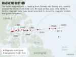
Our planet is restless, and its poles are wandering. The geographic north pole is still in the same place it always was, but its magnetic counterpart – indicated by the N on any compass – is roaming towards Siberia at a record-breaking pace, as reported by sciencealert.com.

It’s worth stating that while the speed is remarkable, the movement itself isn’t. The magnetic north pole is never truly stationary, owing to fluctuations in the flow of molten iron within the core of our planet, which affect how Earth’s magnetic field behaves:

“Since its first formal discovery in 1831, the north magnetic pole has travelled around 1,400 miles (2,250 km),” the NOAA’s National Centres for Environmental Information (NCEI) explains on its website.

“This wandering has been generally quite slow, allowing scientists to keep track of its position fairly easily.”

That slow wander has quickened of late, however — in recent decades, the magnetic north pole accelerated to an average speed of 55 kilometres (34 miles) per year.

The most recent data suggest its movement towards Russia may have slowed down to about 40 kilometres (25 miles) annually, but even so, compared to theoretical measurements going back hundreds of years, this a phenomenon scientists have never witnessed before.

“The movement since the 1990s is much faster than at any time for at least four centuries,” geomagnetic specialist Ciaran Beggan from the British Geological Survey (BGS) told FT.

“We really don’t know much about the changes in the core that’s driving it.”

While researchers can’t fully explain the core fluctuations affecting the north pole’s extreme restlessness, they can map Earth’s magnetic field and calculate its rate of change over time, which helps us to predict how it may be distributed in the future.

1576936073439.png
That system produces what is called the World Magnetic Model (WMM): a representation of the field that powers everything from navigational tools like GPS to mapping services and consumer compass apps, not to mention systems used by NASA, the FAA, and the military, among other institutions.

Despite its importance, the WMM’s powers of foresight – like the magnetic north pole itself – are not set in stone, and the readings need to be updated every five years to keep the model accurate.

“Provided that suitable satellite magnetic observations are available, the prediction of the WMM is highly accurate on its release date and then subsequently deteriorates towards the end of the five-year epoch, when it has to be updated with revised values of the model coefficients,” the NCEI explains.

That’s the point we’re up to now, with the bodies that maintain the WMM – the NCEI and the BGS – having finally updated the model last week.
1576936599151.png

The refresh comes a whole year ahead of schedule due to the unusual speed with which the magnetic north pole has been drifting, meaning that the WMM’s predictions have deteriorated faster than usual this cycle, despite the recent slowdown.

While the speed fluctuations seem crazy, it’s actually a more moderate range of pole movement than has happened in Earth’s history: when the magnetic poles move far enough out of position, they can actually flip, something that happens every few hundreds of thousands of years.

There’s no telling for sure when that might happen next, but if and when it does happen, it could have serious implications for humanity. In the meantime, the new WMM data is good until 2025, and rest assured, no imminent flipping is predicted for now, writes sciencealert.com.

1576936321401.png

However, as mounting evidence suggests Magnetic Flips occur on a regular 12,000-ish year cycle, we could be facing a very bumpy ride very soon. In a recent video, Ben Davidson of SuspiciousObservers stated that the shift could be as close as 10-20 years from now, based on the observed data, which is very close to the highly controversial claim by Doug Vogt from the Diehold Foundation for the year 2046 and a super micro-nova strike.

The two events seem to be linked in some way, with the last major outburst from the sun occurring 9700 BC causing the ice sheets to rapidly melt as well as the extinction of most of the world’s mega-fauna at the end of the last Ice Age, in an event known as the Younger Dryas, which just happens to coincide with the last magnetic flip.


1576936463622.png

Davidson, and Dr. Robert M. Shock, have estimated that the micro-nova event was as much as 40 times the power of the most destructive solar storm observed in modern history, the 1859 Carrington event. This would make the Younger Dryas micro-nova as much as an X-100+ solar flare according to the measurement scale currently in use. Quite alarming, especially if this were to repeat any time soon.

The enormous amount of plasma that arrived immediately after the micro-nova event circa 9700 BCE, bombarded the Earth producing an effect similar to one or more major asteroid impacts. This has caused confusion and led many archaeological researchers into mistakenly interpreting historic evidence of impacts causing and/or ending the last ice age, as deriving from asteroid impacts rather than plasma discharges.

In his interview and book, Schoch asserts that ancient records are consistent with a solar flash that wiped out an ancient civilization predating the end of the last Ice Age, widely assumed to be Plato’s Atlantis.

The scientific data on solar flashes goes back several decades. Bradley Schaefer, an astrophysicist at NASA’s Goddard Space Flight Center, wrote a paper titled, “Flashes from Normal Stars” that appeared in the February 1989 edition of The Astrophysical Journal. He dated the beginning of research into solar flashes to a 1959 study by H. Johnson who at the time “performed the only study which is capable of detecting rare flashes from normal field stars.”

Schaefer examined NASA data on glazing discovered on lunar rocks that was first presented in a 1969 paper by T. Gold published in Science who had concluded: “Some glazing is apparently due to radiation heating; it suggests a giant solar outburst in geologically recent times”. Schaefer agreed with Gold’s analysis and reached a similar conclusion:

The existence of a glazing on the top surfaces of lunar rocks has been used as a strong argument for a “solar outburst” where the Sun increased its luminosity by over 100 times for 10 to 100s within the last 30,000 years.

Schaefer went on to describe how such a “solar outburst” (aka solar flash or micro-nova) could result in an Extinction Level Event:

The Younger Dryas Black Mats

Of the 97 geoarchaeological sites of this study that bridge the Pleistocene-Holocene transition (last deglaciation), approximately two thirds have a black organic-rich layer or “black mat” in the form of mollic paleosols, aquolls, diatomites, or algal mats with radiocarbon ages suggesting they are stratigraphic manifestations of the Younger Dryas cooling episode 10,900 B.P. to 9,800 B.P. (radiocarbon years). This layer or mat covers the Clovis-age landscape or surface on which the last remnants of the terminal Pleistocene megafauna are recorded. Stratigraphically and chronologically the extinction appears to have been catastrophic, seemingly too sudden and extensive for either human predation or climate change to have been the primary cause. This sudden Rancholabrean termination at 10,900 ± 50 B.P. appears to have coincided with the sudden climatic switch from Allerød warming to Younger Dryas cooling. Recent evidence for extra-terrestrial impact, although not yet compelling, needs further testing because a remarkable major perturbation occurred at 10,900 B.P. that needs to be explained.

So, there’s an ever-mounting body of evidence that a major shift is imminent.

So, why aren’t we being told about it?


I know, I know.

Silly me.

“Shut up and pay your taxes.”
 

Attachments

  • 1576936073987.png
    1576936073987.png
    924.2 KB · Views: 1
Last edited:

Seeker22

Has No Life - Lives on TB

New study blames underwater volcanism for catastrophic global cooling, famine, civil upheavals in Medieval times

December 20, 2019 by Robert


This confirms what I’ve been saying years, that underwater volcanoes can lead, not only to cooling, but to ice ages.
___

Researchers presented underwater volcanism as the reason why the sky went dark for more than a year beginning 536 A.D. At that time, some parts of Europe and Asia saw the Sun for only about four hours a day, and even when the Sun was visible, accounts say it gave no more light than the Moon for 18 months. The dimming led to catastrophic global cooling, famine, and civil upheavals in Medieval times.

This period of darkness and cooling marked the beginning of a longer period from 536 to 555 A.D. as trees struggled to grow, indicating that the dimming was extensive.

536 A.D. was also one of the worst periods to be alive, according to Harvard University medieval historian Michael McCormick, who is not part of the study.

“People thought it was the end of the world,” said Dallas Abbott who studies paleoclimate and extraterrestrial impacts at Columbia University’s Lamont-Doherty Earth Observatory.

Abbott and her colleague John Barron from the USGS said their study of a Greenland ice core (GISP2) pointed to underwater eruptions near the equator that carried calcium-laden sediments and microscopic sea creatures into the atmosphere, which helped dim the sunlight.

“We found by far the most low-latitude microfossils that anybody’s ever found in an ice core,” said Abbott.

Undersea volcanism as the cause of 'year of darkness' and upheaval period from 536 - 555 A.D.
Thanks to Guy Wilson for this link

Related:

“New ice core evidence for a volcanic cause of the A.D. 536 dust veil” – Larsen et al. – Nature – DOI: 10.1029/2007GL032450

Abstract

New and well‐dated evidence of sulphate deposits in Greenland and Antarctic ice cores indicate a substantial and extensive atmospheric acidic dust veil at A.D. 533–534 ± 2 years. This was likely produced by a large explosive, near equatorial volcanic eruption, causing widespread dimming and contributing to the abrupt cooling across much of the Northern Hemisphere known from historical records and tree‐ring data to have occurred in A.D. 536. Tree‐ring data suggest that this was the most severe and protracted short‐term cold episode across the Northern Hemisphere in the last two millennia, even surpassing the severity of the cold period following the Tambora eruption in 1815.

Thanks for posting this. Somebody finally connected the dots on this and got it right. Much more underwater mapping needs to be done and soon.
 

TxGal

Day by day
Adapt 2030 has a new podcast out:

View: https://www.youtube.com/watch?v=P88t-zdFyS4


Money During The Grand Solar Minimum and Don't Buy Christmas Presents

Run time is 12:29

Don't buy Christmas presents to fight off climate change, the new talking point, lets stop the ships first. Argentina raises export tariffs on food 3X in a week, massive lurking buyers so the staples need to stay in country. Axumite gold, Denarius and Shekel silver coinage was worth how much food by weight?
 
Status
Not open for further replies.
Top